
Barunga
Barunga, also known as Bamyili, is in the Nyirranggulung Ward and is located 80 kilometres south-east of Katherine on the Central Arnhem Road

Borroloola
Borroloola is in the South West Gulf Ward. It is situated on the eastern coast of the Northern Territory in the Gulf of the Carpentaria and on the banks of the McArthur River
Bulman (Weemol)
Bulman (also called Gulin Gulin, Mardrulk or Yulngu) and Weemol are located in the Nyirranggulung Ward.
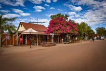
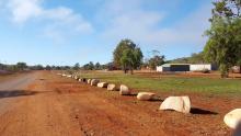
Daly Waters
Daly Waters is located in the Never Never Ward in the Birdum region, 307 kilometres south of Katherine. Image: Tourism NT

Jilkminggan
Jilkminggan is located in the Never Never Ward, 146 kilometres south-east of Katherine and 38 kilometres from Mataranka.

Larrimah
Larrimah is located in the Never Never Ward in the Birdum region, 182 kilometres south of Katherine

Manyallaluk (Eva Valley)
Manyallaluk, also known as Eva Valley, is located north-east of Katherine in the Nyirranggulung Ward

Mataranka
Home of the Never Never. Mataranka is located in the Never Never Ward and is 108 kilometres south of Katherine on the Stuart Highway.
Minyerri (Hodgson Downs)
Minyerri is also known as Hodgson Downs, as the Minyerri Township is very near the site of the Hodgson Downs Station Residence

Ngukurr
Ngukurr is located in the Yugul Mangi Ward and is 331 kilometres south-east of Katherine on the Roper Highway.

Numbulwar
Located in the Numbulwar Numburindi Ward, Numbulwar can be found at the mouth of the Rose River.

Robinson River
Robinson River is located in the South West Gulf Ward and is 144 kilometres south-east of Borroloola.

Urapunga
Urapunga is a township in the Yugul Mangi Ward, located on the Wilton River 30 kilometres west of Ngukurr off the Roper Highway
Wugularr (Beswick)
Wugularr, also known as Beswick, is in the Nyirranggulung Ward 118 kilometres south-east of Katherine

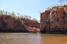
Our Region
Our region runs from the Southern side of Kakadu to the Northern edge of the Barkly Tablelands, and from the Western fringe of the Stuart Highway to the Gulf of Carpentaria and Queensland border
Roper Gulf Regional Council delivers a wide range of services within one of the most spectacular and remote areas of the Northern Territory. Image: Tourism NT/Sean Scott